Record Snow pack, floods next?

I Lean

Mbryson's hairdresser
Vendor
Location
Utah
But mountain dell is empty due to dam repairs.

Best we can hope for is a gradual runoff I guess. I've got paddle boards to use if I need to get to work
Is that current? This article says they're releasing water from Little Dell and Mountain Dell in anticipation of runoff concerns.


Greg

Make RME Rockcrawling Again!
Admin
I’d guess very little for Powell. It’s a massively deep reservoir, while the GSL is crazy shallow.

The San Juan mountains in Southern CO are at 177% of normal snow pack and they drain into Powell, I think the runoff will make a pretty good dent in Powells level. I don't know that it'll 'save' the lake but it should make a difference.
 

Stephen

Who Dares Wins
Moderator
Is that current? This article says they're releasing water from Little Dell and Mountain Dell in anticipation of runoff concerns.

If you read the whole articles it says: "Mountain Dell Reservoir is currently empty as it undergoes repairs, though the water from the other reservoir runs through a bypass set up in the canyon."
 

Stephen

Who Dares Wins
Moderator
At what point do they start to tune up the Hogup pumps?
It would take the Army Corps of Engineers at least six months to re-dredge the canal's leading to and from the pumps and about a year for the State to refurbish the pumps and get them running again. That said, we are many years away from the flood levels of the lake in the early and mid 80's. But I'd love for us to get there again!
 

cruiseroutfit

Cruizah!
Moderator
Vendor
Location
Sandy, Ut
At what point do they start to tune up the Hogup pumps?

Hopefully about 3 years before they are needed :D

ExpeditionUtah members were able to do a tour of the pumps a few years back. It’s a pretty monument task to bring them back on line including new fuel supply lines, dredging the outlet canal and full a full repower as I recall. I don’t remember the exact timeline but I recall they were going to need a few years to make it happen but did have a plan in place.
 

Cody

Random Quote Generator
Supporting Member
Location
East Stabbington
Is that current? This article says they're releasing water from Little Dell and Mountain Dell in anticipation of runoff concerns.

That's the article I got my info from ... And I've driven by recently and can confirm it's as empty as my dark heart.
 

Hickey

Burn-barrel enthusiast
Supporting Member
The San Juan mountains in Southern CO are at 177% of normal snow pack and they drain into Powell, I think the runoff will make a pretty good dent in Powells level. I don't know that it'll 'save' the lake but it should make a difference.
Looking at the data, Powell lost about 20’ of elevation since it’s high point in July of 22 to mid-March, when it started climbing again. It’s 178’ below full pool right now. I doubt we will see it rise more than 60’ this year.


Hickey

Burn-barrel enthusiast
Supporting Member
Looking at the data, Powell lost about 20’ of elevation since it’s high point in July of 22 to mid-March, when it started climbing again. It’s 178’ below full pool right now. I doubt we will see it rise more than 60’ this year.

That’s a depressing website to peruse. 2018 was a high mark for the last decade at Powell, and 92’ above todays levels on todays date. The lake is currently 29’ below safe use of Wahweap Marina, the lowest accessible marina on the lake. Hite is 123’ below useful levels.
 

Stephen

Who Dares Wins
Moderator
Good photo gallery of the '83 floods here:

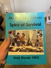
I've got an awesome book that the Trib put out in '84 of their coverage of the floods. I'll have to dig that out. I also have a picture of me, my mom and sister standing at the corner of 1300 S and 300 W next to the "river" heading west to the Jordan River. I was only nine months old, but I remember it like it was yesterday! :D
 

Hickey

Burn-barrel enthusiast
Supporting Member
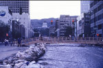
Good photo gallery of the '83 floods here:

I've got an awesome book that the Trib put out in '84 of their coverage of the floods. I'll have to dig that out. I also have a picture of me, my mom and sister standing at the corner of 1300 S and 300 W next to the "river" heading west to the Jordan River. I was only nine months old, but I remember it like it was yesterday! :D
I remember walking over these temp bridges to get to Utah Idaho School Supply where my Mom worked back then.
15F042F6-5719-46B1-8615-3C6E2AD48F3B.jpeg
 
Top