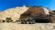
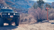
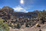
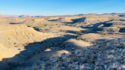
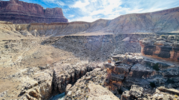
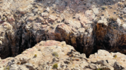
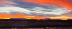
Trip Report Swell 2023 YE trip with Wasatch Cruisers

moab_cj5

Well-Known Member
Supporting Member
Short version: We went, we explored, we encountered plenty of adventure, we camped, we had a few pucker moments, we had some awesome campfires, and we had fun!

Longer Version:
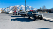
Several of us met on the afternoon of 12/27/23 for a year end trip of wandering in the Swell. My buddies Pedro and Kevin mentioned the trip at the Wasatch Cruisers' Christmas Party and I wanted in! Unfortunately, Kevin couldn't make it but Pedro and I connected to plan a fun trip. We layed out a route across several roads we hadn't driven and set out to explore as many as we could.
1704390004427.png

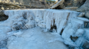
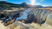
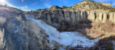
Wednesday, we met at 1pm in Spanish Fork to kick off the festivities. Gassed up and ready for adventure, we cruised over HWY 6 to Helper where we took a small detour. We buzzed up to Gordon Creek Falls and then to the Gordon Creek Railroad Tressel.

The falls were frozen and very photogenic!
1704390067636.png

1704390090957.png

1704390124948.png

The road to the falls was our first opportunity to use 4WD and lockers in some instances. It was fun to exercise the rigs on day 1!

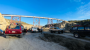
The tresell was cool in its own right.
1704390237843.png

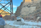
Crossing the river under the tresell was our 2nd adventure. It was frozen, and much deeper than it looked. The first 2 trucks got through under their own power with lockers locked, plenty of skinny pedal, and some sheer luck! The last 2 got strapped out, but no shame was given as it was a tricky spot fo sho!
1704390325006.png

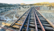
Once on top the view was pretty awesome!
1704390295335.png

Pressing on, the road we wanted to get to Huntington was seasonally closed, forcing us to back track a bit and drop into Price before turning South. We fueled up in Castledale, then set sights on camp just East of Ferron, somewhere in the San Rafael Swell. As we buzzed down the road in Ferron, a few deer surprised me on the right side of the road. I hit the brakes, but it was too late, i hit and killed a small buck. We stopped to ensure the deer was dead and suffering (he was dead), then assessed any damage to my cruiser. There were a few tufts of hair stuck to the bumper and under the cruiser, and some fluid (spit?) on the bumper, but no discernable damage. We drug the little deer off the road, then continued on our quest for camp.

A road to the north looked promising, and as we explored found a cool camp on a ridge, overlooking Ferron and Castledale. We setup camp for the night and got a fire going to cook dinner. We had an awesome night in camp!

Castledale glowing at night.
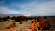
1704390370673.png

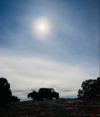
An 80 by moonlight...
1704390428893.png

That night wasn't terribly cold, and the stoke was high for the next day's adventure. The campfire was good for my soul!
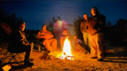
1704390541538.png
 
Last edited:

moab_cj5

Well-Known Member
Supporting Member
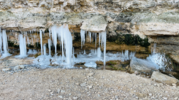
Thursday morning, with camp packed up and tires aired down, we hit the trail towards Fix-It Pass. We made good time through Coal Wash and stopped to get some pics of the ice springing from the rock, Slipper Arch, and some views of the Swell around us.
1704390743230.png

Slipper Arch
1704390771715.png

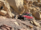
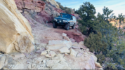
At the base of Fix-It Pass, we got a few folks out for video and pictures. Apparently they all took video (at least that I have seen) as this is the only picture I have of the rigs going up Fix-It.
1704390864029.png

The rough section is short, has a few big rocks, and a few consequences for mistakes, but we made quick work of it and had all the trucks up in about 15 minutes. Dick Dyatt showed us all up by driving up without a spotter and not getting stopped once. A great time on a few fun obstacles! I will see about getting the video uploaded to YouTube and posted here.

At the top, I snapped a few more pics.
1704390908323.png

1704390963167.png

We explored a few more spur roads before stopping for lunch. Pressing on with food onboard, we worked our way south toward the Head of Sinbad area. The road was a bit rough, and the pace was slow. It didn't help that we detoured on a spur to the north that added a bit more spice to the adventure than many felt comfortable with.

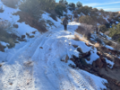
The road was narrow, covered in a slick layer of snow and ice, and to add to the heat - off camber. 2 of the 4 trucks traversed the area with ease, but the last 2 slid into some washouts that added some pucker to the trip. Hopefully the seat creases will ease from the drivers clinching their butts...

The pics don't do it justice, the washouts were deep... and sketchy. We didn't get pics before doing some road work to fill them in a bit with rocks, but here is one pic after.
1704390987547.png

Getting the the trucks through, we got to a point that was beyond the comfort level for the group: a narrow, off camber, loose spot that would have the trucks holding onto precious little traction around a corner. It was decided to back up, turn around, and backtrack through the sketchy spots to continue our journey.

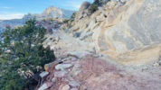
It doesn't look too bad...
1704391067836.png

But it doesn't look too good either...
1704391093759.png

After about an hour of careful backing, road building, and nervous driving, we had all 4 trucks back on the main trail and heading south. It was a fun detour that provided an excellent opportunity for team building and problem solving!

We drove a few more less traveled spurs and found some more awesome views.
1704391122016.png

With daylight fading and nerves in need of a break, we settled into camp right off Buckhorn Wash Rd southeast of The Wickiup so @TheYETI had an easy exit the next morning.

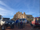
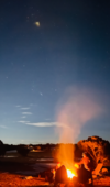
With another roaring fire, we settled in for a fun night of hanging by the fire and reminiscing on the days adventure. The moon rise was breathtaking, and around 9pm @cruiseroutfit rolled in and joined us at camp. Stories were shared, wood was burned, friendships were strengthened; it was a great night indeed!
1704391170158.png
 
Last edited:

moab_cj5

Well-Known Member
Supporting Member
That night was a bit colder than the night before, but enjoyable for winter camping. After breakfast and breaking camp, a couple of vehicles headed for home. That left 3 vehicles for the day's adventure.

We dropped into Road Hollow and rallied through the wash and canyon a bit. Shortly after Pedro commented how much he loved his suspension, a lower shock bolt on the rear axle of his truck decided it had seen enough abuse and promptly exited the vehicle. This resulted in a new noise for Pedro and prompted us to come to a stop to investigate. Upon inspection, it was found the shock shaft was bent, and despite finding the parts that had made a hasty escape, the shock needed to come off and will ultimately need to be replaced. With tools out, we removed the shock and got the truck ready to roll, albeit a bit slower with only 1 rear shock. I don't know if anyone took any pictures of this process, but I know I didn't.

Rolling again, we made our way to Cane Wash and cruised north to the end of the wash. Cane wash is a blast to drive! The views are awe inspiring, and the wash is a good fun drive.

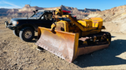
Exiting on the north end we stopped to check out some roads below Calf Mesa, and check out some mining relics.

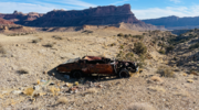
A cool old dozer abandoned on the bluff.
1704391369221.png

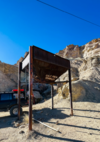
An old hopper weathering the elements well.
1704391403152.png

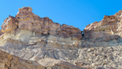
The old road up to the adits (a hike for another day).
1704391435735.png

Within striking distance of the Swinging Bridge campgrounds, we made our way north and ate lunch on the south side of the river. It was a beautiful day and a great place to pause the adventure for some food and discussion.

Pedro decided to call it a trip there and head for home. I didn't blame him, he had a truck full of people and gear, and only 1 rear shock. I didn't know what lay ahead for us, but in hind sight, it was good Pedro passed on the rest of the adventure.

Kurt and I looked at the map and discussed the route I had layed out, then decided to press on exploring the spur roads that had been identified. We buzzed south and started down these roads. Some were short and sweet, others long and tedious. Views varied on each trail, but they were all beautiful!
1704391476514.png

The sun was setting as we reached the end of a road that led close to the river near Lockhart Box. I snapped this picture because I catagorically oppose a wilderness designation for any area that has ever, and still has, a road through it... Fix the road and let us drive it!
1704391541703.png

We didn't walk to the river with the sun fading, so if I ever want to punish myself on that rocky, rough road again, I will complete the walk then. The sun set though, was pretty cool!
1704391565258.png

Closer to Buckhorn, on a short spur road, we found a pretty awesome place to camp and settled in for the long winter's night.
 
Last edited:

moab_cj5

Well-Known Member
Supporting Member
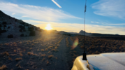
Saturday morning we were treated to another beautiful sunrise! I didn't grab my phone in time to get the best colors, but this photo will have to do.
1704391688702.png

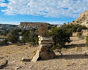
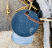
Continuing the theme of exploring spur roads, we stumbled upon a make shift pet cemertary. There were 4 stone monuments erected on a ridge, each with a dog collar attached to a rock in the pile. Only one of the collars had tags that were still readable.
1704391746939.png

1704391778197.png

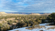
A cool vista.
1704391718041.png

We kept exploring roads, taking in the sights, and snapping a few pictures. One of our goals for the day was to get to Swazys (Sid's, or Swazey's) Leap. That road is rocky and bumpy too. Too rough to go fast, but not so rough you want to use low range: a brutally bumpy drive. At the end of the legal road, we parked at the fence and hiked the 2.5 miles to the overlook of the leap. More info and history can be found here. The hike follows a perfectly drivable road all the way to the overlook. I swallowed my frustration that the .gov in their infinite wisdom had closed access to this road to motorized use. I again contend this area does not qualify for Wilderness designation as it has a historic and important road right through the area. At a minimum, the road should be cherry stemmed and open for use.

A remnant of when the remainder of the road was legal to drive.
1704391827648.png

Above the Upper Black Box
1704391851152.png

The 14' gap Sid jumped his horse over.
1704391872055.png

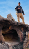
A fearless adventurer admiring the many rock formations.
1704391900634.png

I can't imagine driving sheep through that country. Those rocks are sharp and inhospitable!

After returning to the cruisers, we pressed on to see how close we could get to Sulphur Spring. We were treated to more amazing views despite another rough and bumpy road. At the end, we found another road perfectly drivable still but closed to motorized use for some stupid reason...

A panoramic view of the cliffs.
1704391960569.png

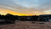
Frustrations aside from roads and access closures, we continued on into Black Dragon Canyon. We had identified a road I hadn't driven before and decided to check it out. A steep climb on a road less traveled, and we were staring at I-70. We jumped on the freeway to the rest area, took in the views while I aired up my tires, and decided to head into Green River for dinner at Ray's. Little did we know at the time, Ray's closed for the month of December. Plan B was to cruise up to Helper and grab dinner at Balance Rock Cafe before setting course for home. On HWY 6, we were treated to another amazing sunset!

Pictures just don't do it justice!
1704391986605.png

A great ending to a great adventure! It was a blast hanging out with everyone and exploring some new to me areas. A fantastic wrap to 2023! Here's to many more awesome trips and people in 2024!
 
Last edited:
anderson750

I'm working on it Rose
Location
Price, Utah
Saturday morning we were treated to another beautiful sunrise! I didn't grab my phone in time to get the best colors, but this photo will have to do.
View attachment 168301

Continuing the theme of exploring spur roads, we stumbled upon a make shift pet cemertary. There were 4 stone monuments erected on a ridge, each with a dog collar attached to a rock in the pile. Only one of the collars had tags that were still readable.
View attachment 168303

View attachment 168304

A cool vista.
View attachment 168302

We kept exploring roads, taking in the sights, and snapping a few pictures. One of our goals for the day was to get to Swazys (Sid's, or Swazey's) Leap. That road is rocky and bumpy too. Too rough to go fast, but not so rough you want to use low range: a brutally bumpy drive. At the end of the legal road, we parked at the fence and hiked the 2.5 miles to the overlook of the leap. More info and history can be found here. The hike follows a perfectly drivable road all the way to the overlook. I swallowed my frustration that the .gov in their infinite wisdom had closed access to this road to motorized use. I again contend this area does not qualify for Wilderness designation as it has a historic and important road right through the area. At a minimum, the road should be cherry stemmed and open for use.

A remnant of when the remainder of the road was legal to drive.
View attachment 168305

Above the Upper Black Box
View attachment 168306

The 14' gap Sid jumped his horse over.
View attachment 168307

A fearless adventurer admiring the many rock formations.
View attachment 168308

I can't imagine driving sheep through that country. Those rocks are sharp and inhospitable!

After returning to the cruisers, we pressed on to see how close we could get to Sulphur Spring. We were treated to more amazing views despite another rough and bumpy road. At the end, we found another road perfectly drivable still but closed to motorized use for some stupid reason...

A panoramic view of the cliffs.
View attachment 168309

Frustrations aside from roads and access closures, we continued on into Black Dragon Canyon. We had identified a road I hadn't driven before and decided to check it out. A steep climb on a road less traveled, and we were staring at I-70. We jumped on the freeway to the rest area, took in the views while I aired up my tires, and decided to head into Green River for dinner at Ray's. Little did we know at the time, Ray's closed for the month of December. Plan B was to cruise up to Helper and grab dinner at Balance Rock Cafe before setting course for home. On HWY 6, we were treated to another amazing sunset!

Pictures just don't do it justice!
View attachment 168310

A great ending to a great adventure! It was a blast hanging out with everyone and exploring some new to me areas. A fantastic wrap to 2023! Here's to many more awesome trips and people in 2024!
If you have a location for the pet cemetery, shoot it over to me. I would like to go and check it out.
 

TRD270

Emptying Pockets Again
Supporting Member
Location
SaSaSandy
The old road up to the adits (a hike for another day).
1704391435735.png
Nice report. I've scoped those with the drone, and made the hike. They are sealed
 

cruiseroutfit

Cruizah!
Moderator
Vendor
Location
Sandy, Ut
Top