You are using an out of date browser. It may not display this or other websites correctly.
You should upgrade or use an alternative browser.
You should upgrade or use an alternative browser.
Bureau of Land “Management” going after the swell now
- Thread starter TRD270
- Start date
- Location
- Sandy, Ut
All, start researching and making notes on the routes you've driven (or want to drive) on this SRS TMP. There are some amazing resources being spooled behind the scene that will help educate our community on why, how, when and where to comment, once the comment period actually opens.
Many of you likely remember the 'Letter Writing Parties' we (U4WDA) hosted back when the Moab, Price, Richfield, Monticello, Vernal, etc were going through their RMP revisions. We (motorized access community) faired quite well in all these, so much so SUWA and cohorts sued.
Also, the Bears Ears RMP is also happening, it launched March 8th and it has it's own Travel Management contingent. I'm about six hours into reading through the EIS and map documents, it's a fortunately their preferred alternative (E) isn't nearly as horrific as the Swell TMP alternatives (preferred included) but it does eliminate the historic Arch Canyon route and others. The D alternative is certainly the one the anti-access crowd will be pushing hard for, it is pretty brutal including Arch Canyon, Bull/Imperial Valley (@Cody, this is the access below Impossible Hill/Bobby's Hole we were just chatting about). I'm working on some notes on that RMP, you can follow along my path of thought here: https://expeditionutah.com/forum/index.php?threads/bears-ears-nm-resource-management-plan.8081/
Last edited:
Thanks Shane!
- Location
- Sandy, Ut
Fantastic, thanks for doing that.
Can I have permission to share? @anderson750, check out Shane's work. Now we need PLPCO to add KML and preferably GPX to their site too!
Fire away!Fantastic, thanks for doing that.
Can I have permission to share? @anderson750, check out Shane's work. Now we need PLPCO to add KML and preferably GPX to their site too!
They didn't have much data to convert from, just an ID and miles plus the shape... but now that it's in KML, it can be traced into a GPX as needed or just used to find the start/end coords much easier.
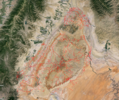
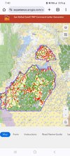
Edit - Also do note that not all routes in that KML are marked for closure. Might have to do some comparison with the map above to verify the status they intend to set. This just dumped all the ones from that map and they are all the same color.
Hey thanks for giving something to do this evening! Keeps me out of the other 2 threads...Thanks Shane!
- Location
- Sandy, Ut
Edit - Also do note that not all routes in that KML are marked for closure. Might have to do some comparison with the map above to verify the status they intend set. This just dumped all the ones from that map and they are all the same color.
That's fine for me. I'll be using the State's comment generator site to identify the routes I need to comment on and/or go drive. And your KML file will make it easy to grab some GPS coords to toss in my mapping software to build a drive agenda.
Here I just found this from their /hosted/ directory. This is a quicker /easier way to compare to the KML version:That's fine for me. I'll be using the State's comment generator site to identify the routes I need to comment on and/or go drive. And your KML file will make it easy to grab some GPS coords to toss in my mapping software to build a drive agenda.
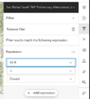
Use the filters on the right to see each plan filtered by closer or open (A,B,C)

Also I'd like to bring more attention to this:
Click any of those, then on the next page click "ArcGIS Online Map Viewer" to see the data on their map.
If needed I can dump any of those to a KML in the future as well.
.gpx format. Unfortunately seems to large for any program I use. Going to try and break it up a bit.
 www.icloud.com
iCloud Drive - Apple iCloud
Store, organize and collaborate on files and folders with iCloud Drive. Easily upload, delete or recover files. Changes will sync across your devices with iCloud.
Now can you save it as red and green as they have it? That'll keep you busyHey thanks for giving something to do this evening! Keeps me out of the other 2 threads...
If you want to export on your own. I'm going to work on changing the colors. Be aware it takes a loooooooooong time to load. At least on my computer.
anderson750
I'm working on it Rose
- Location
- Price, Utah
I’ll check it out when I get back to my office on Tuesday when I can look at it in a bigger screen than my laptop. Thanks ShaneFantastic, thanks for doing that.
Can I have permission to share? @anderson750, check out Shane's work. Now we need PLPCO to add KML and preferably GPX to their site too!
Shane any chance to pull data for just proposed closures and plot them? I'm making headway on my cal topo but man its taking a long time. Since some intersections are broken down into as many 6 tracks.
End goal here is to have an overlay to show proposed closures, to help everyone document/put tracks on them. I'm only working on one proposal and not sure I'll have patience to do overlays for the others
End goal here is to have an overlay to show proposed closures, to help everyone document/put tracks on them. I'm only working on one proposal and not sure I'll have patience to do overlays for the others
- Location
- Sandy, Ut
Shane any chance to pull data for just proposed closures and plot them? I'm making headway on my cal topo but man its taking a long time. Since some intersections are broken down into as many 6 tracks.
End goal here is to have an overlay to show proposed closures, to help everyone document/put tracks on them. I'm only working on one proposal and not sure I'll have patience to do overlays for the others
Why not use the States website that does exactly this?
- Location
- Sandy, Ut
Ohh yeah, sorry. Trying to export only the red lines, instead of all lines to put on mapping software. Make it easier to connect the dots on places to visit.Ummm, you posted the link in the original thread.
It let's you select routes, see what Alternatives do to said route and add that route to a list your commenting on.
View attachment 170608
Wasn't sure if Shane's voodoo science witchery could sort the binary and filter.
I think that I did what your asking here but could be wrong...?Shane any chance to pull data for just proposed closures and plot them? I'm making headway on my cal topo but man its taking a long time. Since some intersections are broken down into as many 6 tracks.
End goal here is to have an overlay to show proposed closures, to help everyone document/put tracks on them. I'm only working on one proposal and not sure I'll have patience to do overlays for the others
I split each of the proposals out with closures only into 3 separate KML files in this post:

Bureau of Land “Management” going after the swell now
Boom! I was able to convert all 2k routes to a KML file
Here are “revB closed”, “revC closed” and “revD closed” kml files split out
Last edited:
If you want to export on your own. I'm going to work on changing the colors. Be aware it takes a loooooooooong time to load. At least on my computer.
I "think" I'm done north of 70, ended up just starting to delete open trails for "B" plan. was taking way to long to change the colors. I'm hoping shrinking it down to closed trails will make the file more manageable for export.


