

You are using an out of date browser. It may not display this or other websites correctly.
You should upgrade or use an alternative browser.
You should upgrade or use an alternative browser.
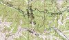
Middle Canyon - Butterfield Canyon Info...
- Thread starter cruiseroutfit
- Start date
Right, and since nearly every comment on the canyons here have been referred to as east of the saddle or west of the saddle (or SL County side and Tooelle side), I said the "east side" is fenced off. I guess I should clarify a bit for those special people and say the north and south sides, but only the sides of the roads, on the east side (SL County side...Butterfield Canyon) have been fenced off. I figured we were smarter than that here and we had already established the road was open all the way from one side to the other...but hey, whatever I'll remember to spell it out very clearly for the special people next timebut they are 2 different canyons.. and the canyon goes east and west.. the north and south side is fenced off in butterfield but there is still a road HEHE
- Location
- Bountiful, land of rocks
but they are 2 different canyons
ZUKEYPR
Registered User
- Location
- 651.78 miles East of the Rubicon
If you really want to split hairs the saddle borders Tooele County and Utah County, not Salt Lake County.
- Location
- Sandy, Ut
If you really want to split hairs the saddle borders Tooele County and Utah County, not Salt Lake County.
The saddle in the road would be SLC and Tooele no?
Attachments
I was going to say I thought the Utah Co. border was a bit south still.The saddle in the road would be SLC and Tooele no?
FWIW, anyone that cares, they have Google street view all the way up and over the top of the canyon.
(that shows you how easy of a drive it is up and over )hoxviii
Ford-natic
- Location
- Draper, UT
Anyway, i worked my way out there today after work and it is pretty darn impressive up there.
Only thing was, the directions given were iffy at best since 7800S T's into 6400 E, the whole time i was looking i never saw an actual 8400W. Oh well, i made it
Regardless, from there I just started working south and west until I came upon the wild horse and burro preserve sign, then went up the gated road- this time bearing north and west whenever possible.
Actually found out the 7800 route is the LOOOOONG way for me.
From Draper all I really had to do was drive out 12300S going west until the horse and burro preserve. Found that out since on the way home i decided to go the other way since it looked like i was pretty well in line with draper anyway.
At the saddle I saw 6 roads. The one to the overlook, the one back to SLC, the one to Tooele, and what looked like 2 ATV trails and one small 4x4 trail.
Anything of interest up any of those three?
Justin
Tacoma
Et incurventur ante non
- Location
- far enough away
Not really.
Sorry about that (I know it's 8400 W. farther north, it apparently changes to about 6800 W. at 7800 S.)...FWIW, it wouldn't have been 6400 EAST, 6400 East would be all the way on the east side of the valley. Maybe 6400 West, but I don't think there is a crossroads there. Anyways, if I had known you were coming from Draper, then yeah...it's a straight shot up 12300 S.Anyway, i worked my way out there today after work and it is pretty darn impressive up there.
Only thing was, the directions given were iffy at best since 7800S T's into 6400 E, the whole time i was looking i never saw an actual 8400W. Oh well, i made it
Regardless, from there I just started working south and west until I came upon the wild horse and burro preserve sign, then went up the gated road- this time bearing north and west whenever possible.
Actually found out the 7800 route is the LOOOOONG way for me.
From Draper all I really had to do was drive out 12300S going west until the horse and burro preserve. Found that out since on the way home i decided to go the other way since it looked like i was pretty well in line with draper anyway.
At the saddle I saw 6 roads. The one to the overlook, the one back to SLC, the one to Tooele, and what looked like 2 ATV trails and one small 4x4 trail.
Anything of interest up any of those three?
Justin
Oh well, you know where it is now hoxviii
Ford-natic
- Location
- Draper, UT
Oops, yeah, 6400W.
Like i said, you got me going the right direction, I just had to figure the the bits out.
Justin
Like i said, you got me going the right direction, I just had to figure the the bits out.
Justin
- Location
- Sandy, Ut
Bump for an old thread. Anyone been up to the top of the old road in White Pine Canyon? Know anything about the 'mines' up there? How far does the road go?
The large mine waste dump and portal, presumably owned by KUC, any idea what that mine was called? Was it an actual mine or a haulage tunnel or drain? Its obviously well maintained, under lock, key and camera. I just want to know the name of it.
The large mine waste dump and portal, presumably owned by KUC, any idea what that mine was called? Was it an actual mine or a haulage tunnel or drain? Its obviously well maintained, under lock, key and camera. I just want to know the name of it.
- Location
- Sandy, Ut
Edit: Found a bit of info on the Middle Canyon tunnel
"The consolidation of the Bingham-Central Standard, with other property of the camp, forming the Utah Metals Co., was an important occurrence, giving the company control over some 3,300 acres of ground. The development on the Bingham-Central Standard group shows a very large tonnage of' concentrating ore, and for the purpose of getting under this ore, at great depth, the company is driving a large drain and transportation tunnel, from the Middle Canyon side."
This seems completely fitting. Wonder where it ends up now? Pops out in the middle of the pit?
- Location
- Sandy, Ut
We did find something very interesting up there, an old truck partially buried in a wash. Looked as if it got stuck or abandoned and then the water covered it in rocks?
Did some googling and found it was this:

A Republic truck circa ~1920
Did some googling and found it was this:
A Republic truck circa ~1920
We did find something very interesting up there, an old truck partially buried in a wash. Looked as if it got stuck or abandoned and then the water covered it in rocks?
Did some googling and found it was this:
A Republic truck circa ~1920
I had meant to figure out what kind of truck that was but hadn't been back up there to get any distinguishing marks to search with.. that is sweet.. did you get any further up the trail than the truck?
- Location
- Sandy, Ut
I had meant to figure out what kind of truck that was but hadn't been back up there to get any distinguishing marks to search with.. that is sweet.. did you get any further up the trail than the truck?
Yup, all the way to where it peters from a 4-wheeler route into hiking only really (~1.25-1.5 miles up). Its obviously an old road and we did pass 3-4 old 'mines', I use that word loosely as they have all the exterior characteristics of a mine but they actually look like they were horizontal adits into springs? They are plumbed for water. Could be they were older mines that were later plumed to carry the water down? In fact that entire road is on top of a water pipe, ~4" at the top and ~12" towards the bottom after all the collection points. Its final stop that we can see is a valve box surrounded by a chain link fence just off of the Middle Canyon Road. We wanted to continue hiking but it was already 3am (this morning) and we still had to finish the hike back down.
Tacoma
Et incurventur ante non
- Location
- far enough away
Sounds like Scott and I had better lace up the boots and take a walk. Sounds pleasantly interesting.
Tacoma
Et incurventur ante non
- Location
- far enough away
This is interesting as hell. Thank you for planning my weekend!
Thank you for planning my weekend! Edit: Found a bit of info on the Middle Canyon tunnel
"The consolidation of the Bingham-Central Standard, with other property of the camp, forming the Utah Metals Co., was an important occurrence, giving the company control over some 3,300 acres of ground. The development on the Bingham-Central Standard group shows a very large tonnage of' concentrating ore, and for the purpose of getting under this ore, at great depth, the company is driving a large drain and transportation tunnel, from the Middle Canyon side."
This seems completely fitting. Wonder where it ends up now? Pops out in the middle of the pit?
Sounds like Scott and I had better lace up the boots and take a walk. Sounds pleasantly interesting.
Damn Skippy we should
.. I was actually thinking something along these lines as well- Location
- Sandy, Ut
This is interesting as hell.
Keep in mind that quote was from a 1920's mining review journal... your not going to find picks and shovels anytime soon
What you will find is the well secured portal with camera. The waste dump that has been partially reclaimed at the top. The 'water mines' are on the opposite side of the canyon, if you get to the Republic you've already passed one portal that has been reclaimed, but a keen eye will spot the once adit and the drain pipe.