Trip Report October 2023 San Rafael Swell

zmotorsports

Hardcore Gearhead
Vendor
Location
West Haven, UT
The wife and I just returned from spending much of last week in the Swell. The San Rafael Swell has quickly become one of our favorite places to visit as there is such a diverse and interesting landscape to enjoy.

As I've aged I feel less need to prove anything by climbing over rocks and rather enjoy the long drives taking in the scenery, as well as I have a hard time beating on my Jeep and want to keep it nice for many more years to come. :thinking: Those trails that are rock after rock and boulder after boulder have become less appealing to me, but I do like a few obstacles thrown in here and there to play on and work the Jeep's suspension. ;) Maybe that's why the Swell has quickly become one of mine and the wife's popular areas to travel to.

I'm sure many of you may be well versed in the San Rafael Swell area but the wife and I have only been going for about 3 years now. Granted, I've logged quite a few miles in the area in that short amount of time and have become very familiar with the general area but that only has revealed to me that there is so much we haven't seen. For this trip I did a bit more research to find some out of the way things to see and explore a few areas of the Swell that the wife and I are less familiar with.

Enjoy the pictures.

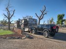
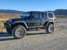
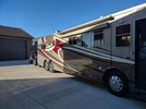
Jeep hooked up to the coach and ready to hit the road.
swell1.jpg


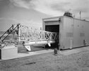
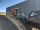
We arrived mid-afternoon and immediately unhooked the Jeep and took off exploring. I had read about the Utah Launch Complex weeks before and the wife and I set out to find it. The Utah Launch Complex was a missile testing site in central Utah that was built in 1961 and went fully active in 1962 and remained active until mid 70's (1973 or 1975 I find both dates of when it was officially shut down). Then in 1986 it was dismantled and what you see in the next few pictures are how it remainds today. It is fully fenced off however, the gates were open so we went inside the area to explore.

The buildings are in complete ruin, but it was interesting to envision what they were like in the mid 60's when they were fully operational.
swell2.jpg


This was an interesting structure. The building itself was on rails and appears it could move back and forth along the tracks and concrete slab. My thinking was that they build the rockets/missiles inside this structure which had a huge overhead trolly style of crane and then was able to move towards the concrete pad at the end of the track which was the launch pad.
swell3.jpg


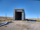
Here is the door at the other end of the structure along with the rails visible in the concrete.
swell4.jpg


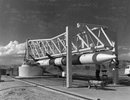
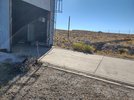
At the far right of the picture you can see the concrete pad above ground. This was actually the launch pad and had steel structures bolt together that held the missile for launch.
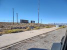
swell5.jpg


These are the metal structures in which I envisioned bolting together to create the missile holding apparatus for launching.
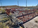
swell6.jpg


The "rack" seen in the picture appears to guide something along the rails parallel to it.
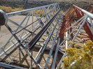
swell7.jpg


Here are several pictures I found of what it looked like when fully operations from the mid 1960's.
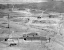
swell8.jpg


swell9.jpg

swell10.jpg


More pictures to follow.
 

zmotorsports

Hardcore Gearhead
Vendor
Location
West Haven, UT
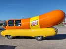
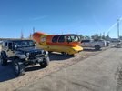
Upon returning to town, we decided to grab some dinner and the Weinermobile had parked next to us. Evidently, they were hungry as well.
swell11.jpg


swell12.jpg


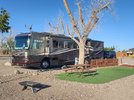
Our campsite for the week.
swell13.jpg


We had absolutely beautiful weather the entire trip.
swell14.jpg


The next day we ran Copper Globe Canyon and dropped into Devil's Canyon.
swell15.jpg


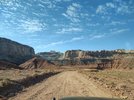
Our lunch spot for the day. Hard to beat these views.
swell16.jpg


swell17.jpg


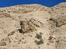
We had the trail completely to ourselves. We did see a flash of something off in the distance a couple of times which I thought was a windshield from another vehicle or something but upon getting over to the other wall of the canyon we found several of these large boulders which appeared to have a lot of glass-like material in them. I think that is what we were seeing reflecting in the distance because we never saw another soul in all 38 off-road miles that day.
swell18.jpg


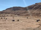
Upon climbing up and out of CAT Canyon, we saw another road turn off to the south in which I didn't notice last trip. We decided to take it for a while and see where it led. We found these interesting rocks that looked like volcanic boulders dropped into the desert. We joked that they looked like dinosaur eggs.
swell19.jpg


As we drove a bit further we found a fairly new bridge crossing the Muddy Creek. We pulled off and I did some playing with my tablet using GAIA and found that the trail we were on actually led down into Cathedral Valley around Torrey, UT and intersected Capitol Reef National Park. I think the wife and I may make this another side trip in a future visit to the area as it was getting late in the day and didn't think we could make it the 20+ miles and back before dark. We definitely have a game plan to explore this trail in more depth during the next trip however.
swell20.jpg


More pictures to come.
 

zmotorsports

Hardcore Gearhead
Vendor
Location
West Haven, UT
The next day we took off into an area we had not explored at all before as I had read about some pictographs on someone's hiking blog a while back. I plugged the GPS coordinates of the pictorgraphs into GAIA and then worked backwards trying to link the closest trails to the pictorgraph's location.

The day started off Highway 6 about 15 miles north of I-70 at the Green River Cutoff trail. This is a direct road across the northern most part of the Swell and takes you to the Wedge, which is known as the "Little Grand Canyon". We have been to the Wedge a couple of times accessing it via a couple different trails but never from this direction. The goal of the day was to find the pictorgraphs, then head to the Wedge for lunch and then leave to the north of the Wedge and take a new to us trail down the east side of the Swell and return to I-70 about 40 miles west of Green River. This would be a long day so we left earlier than usual.

Here we are just pulled off Highway 6 to air down.
swell21.jpg


swell22.jpg


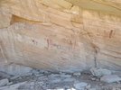
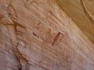
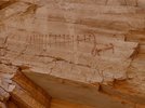
We eventually found the pictographs but it was a long search. Two of the trails in which I had previous marked using GAIA had been closed off using boulders and fencing so we had to locate alternative routes to the pictorgraphs. We ended up accessing them via very, very faint two-tracks that look like they haven't been used in quite some time.

The wife was getting anxious as we were about 25 miles off the main trail and I was basically trying to feel my way around a canyon by any trail we could find. The wife was ready to turn around and head back to the main trail and continue our plans for lunch but I was hell bent on finding the pictographs as it was a mission now.

We did finally locate them but it wasn't an easy route to access. I can see why they were on a hiking blog and not an off-road blog. :rolleyes:
swell23.jpg


swell24.jpg


swell25.jpg


We then tried to pick an easier route back to the main trail but kept getting ridge locked and having to turn and backtrack. We eventually picked out way back to the Green River Cutoff trail and blasted down the road to the Wedge. Although we were slightly behind schedule we made good time and had a nice lunch spot. The Wedge Recreation area was actually quite busy as we saw the first other people in a couple of days of being on the trails.

Our lunch spot overlooking the Wedge.
swell26.jpg


swell27.jpg


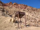
After leaving the Wedge we realized that we didn't have time to go the route I had originally mapped out, so we decided to head back by way of Buckhorn Wash Road. After realizing that Buckhorn Wash was a freakin' highway with all of the traffic and it being so dusty because they hadn't seen any rain in several weeks, I wanted to get off the main trail and find something more "remote" to have to ourselves. After playing with the GAIA app on my tablet I found a trail that somewhat paralleled Buckhorn Wash but on the other side of the ridge down in a wash. As we went through a gated area in the wash we came across this old mine that still had some components remaining.
swell28.jpg


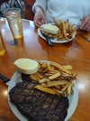
We returned to town just about dusk and decided on dinner. We try to spread the love between a couple of our favorite places to eat in Green River. I was craving a steak and the wife wanted her teriyaki chicken so off to Ray's Tavern.
swell29.jpg


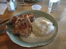
This was from the night before's dinner from our other favorite place to eat, Tamarisk, where I ordered their pork chops. I seem to get these each trip as I have not found pork chops this delicious anywhere else.
swell30.jpg


More pictures to follow..
 

zmotorsports

Hardcore Gearhead
Vendor
Location
West Haven, UT
The trail we ran on the last day was called Behind the Reef. I got the trail's gpx file from a friend we met at our Spearfish, SD gathering about 5 years ago and filed it away for future use.


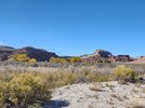
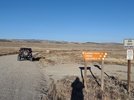
Here is Temple Mountain Wash heading west toward the turn down into the canyon.
swell31.jpg


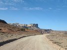
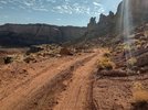
Dropping down into the canyon and along the canyon bottom the road was quite good, just a little rocky in a few areas.
swell32.jpg


Unfortunately, I didn't take any pictures of the two obstacles giving it the higher rating than surrounding trails. The first was just at the bottom of the canyon as you began the climb upwards. The initial obstacle was a deep off-camber ravine that then had a series of boulders to climb.


The obstacle did make me a bit nervous as it was a bit of a mind screw, but it turned out to be a non-issue and the Jeep crawled straight up it without even slipping a tire. The mind-screw came from being on the cliff's edge and being alone on the trail which I didn't like either and neither did the wife. I still can't believe I forgot to get a picture of the obstacle as it looked worse that it was.

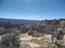
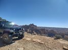
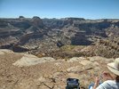
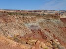
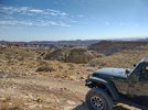
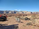
After making the climb out of the canyon this was our view from the canyon wall.
swell33.jpg


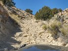
Here is looking back down the trail and into the canyon. You can see the road at the bottom of the trail down in the canyon floor as it was a short and steep climb up out of the canyon. After the initial obstacle it was just large rocks here and there but nothing bad at all. I will admit however, I did fear a little that the obstacle at the bottom of the canyon wouldn't be the worst one and we would find more higher up and the narrow shelf road wouldn't allow us to turn around but that wasn't the case as we easily made the rest of the climb out of the canyon without issue.
swell34.jpg


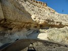
There were several of these outcroppings of rocks and one in particular called "the squeeze" that had two large boulders just a Jeep's width from the outcroppings. I had to pull my passenger's mirror in and my hardtop was about 3 inches off the outcropping as my driver's rear tire just kissed the boulder. I don't think a much higher or longer vehicle would have made that as the boulder you had to maneuver around was almost the size of our Jeep to begin with.
swell35.jpg


This was another little climb just after the "squeeze". It looked worse that it was and turned out to be quite an easy little climb and a hard left turn at the top. Got slighlty off-camber at the hard driver's turn but not bad. The wife didn't even get out for this one so she must have been getting more comfortable.:rofl:
swell36.jpg


Another view down into the canyon.
swell37.jpg


The last climb up towards McKay Flats and then into Red's Canyon. This was a narrow rock garden climb but not bad. The rocks were loose but not big.
swell38.jpg


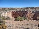
Our lunch spot on top looking down into Red's Canyon.
swell39.jpg


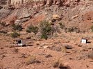
We explored another turn off into a wash that we had not taken before and found another mine back into a slot canyon. We saw the remnants of a structure with some stoves remaining.
swell40.jpg


That was the last day of the trip. All in all I think we covered about 250-miles of off-road trails in the three days we were in the area.

Thanks for looking.
 

zmotorsports

Hardcore Gearhead
Vendor
Location
West Haven, UT
Good stuff sir! I think the RR4W Trail of the Month is Behind the Reef for Nov. Looking fwd to it. Yell if you would like to join us and I'll shoot you some details (Nov 18, if I remember correctly).

Thank you. If I'm available I'd love to go on that trail again. It turned out to be one of my wife's favorite as the views in Chute Canyon are breathtaking. She didn't even mind the couple of obstacles. :rofl:
 

zmotorsports

Hardcore Gearhead
Vendor
Location
West Haven, UT
Good stuff sir! I think the RR4W Trail of the Month is Behind the Reef for Nov. Looking fwd to it. Yell if you would like to join us and I'll shoot you some details (Nov 18, if I remember correctly).

Do you have the details on this trail run? Weather dependent, the wife and I may be looking for something to do this weekend.

Thanks.
 

mbryson

.......a few dollars more
Supporting Member

zmotorsports

Hardcore Gearhead
Vendor
Location
West Haven, UT
Thanks. Still discussing with the wife about driving down Friday night and getting a room. I'm not used to traveling without the coach and despise hotel rooms so this is a stretch for me. :rofl:

If I can juggle some shop work around I would really like to make it as I am jonesing for an off-road fix.
 
Top