Wilson Peak

timpanogos

Push to the Peak
Location
Heber
Wilson peak is the end peak on the North end of Heber Valley. The ridge line goes all the way to Deer Valley, then ties back into Guardsmans pass. My son and I took an afternoon/evening ride ... dang I should have taken the camera, did not expect to be able to make it to the top. We did most of the ridge line.

Meat, you suck, and oh yea, the IRoks kicked butt on wet heavy snow. Did some fairly serious stuff ... ate it up.

Nice ride ... mountain stuff, for the next month or so, can be some real challenging/serious stuff ... screw the snakes, who wants to play in some mudd/snow ... give me a holler.
 

Meat_

Banned
Location
Lehi
Wilson peak is the end peak on the North end of Heber Valley. The ridge line goes all the way to Deer Valley, then ties back into Guardsmans pass. My son and I took an afternoon/evening ride ... dang I should have taken the camera, did not expect to be able to make it to the top. We did most of the ridge line.
this_thread_is_useless_without_pics.gif

Meat, you suck, and oh yea, the IRoks kicked butt on wet heavy snow. Did some fairly serious stuff ... ate it up.
Tell yourself whatever you need to in order to feel good about buying those tires.
Nice ride ... mountain stuff, for the next month or so, can be some real challenging/serious stuff ... screw the snakes, who wants to play in some mudd/snow ... give me a holler.
mud, ick
 

timpanogos

Push to the Peak
Location
Heber
Heber Valley stuff

Here are a few shots as of this morning in the Heber Valley

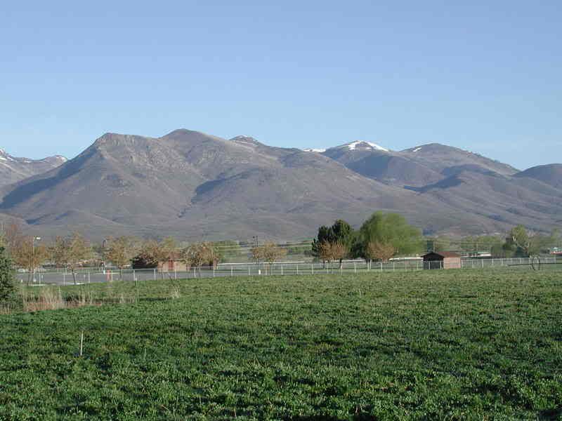
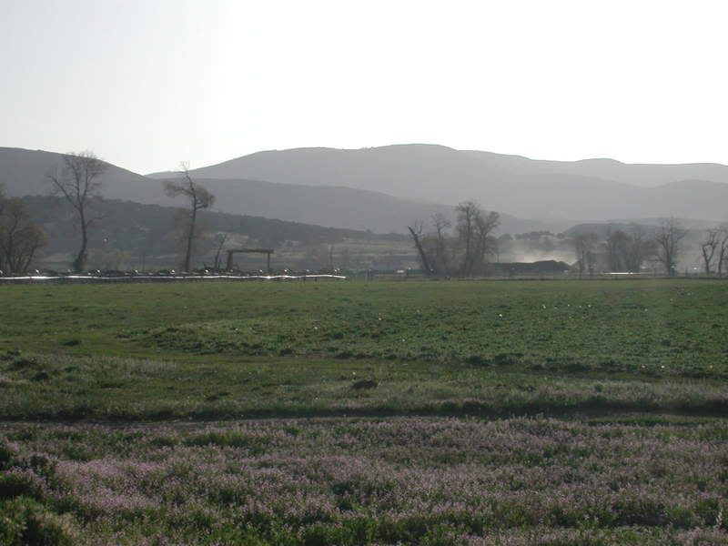
This is taken from behind the Smiths on 600 North and about 4th East in downtown Heber. Looking north west:

Wilson Peak is the end of the ridge line on the left side of the picture. The peak to the right with snow on is Bald peak - top of Wasatch express quad lift at Deer Valley. You run the whole ridge line, hitting the top of each peak on the way ... the ridge line does not look snowy from this angle, but it was.
DSCN2584.jpg


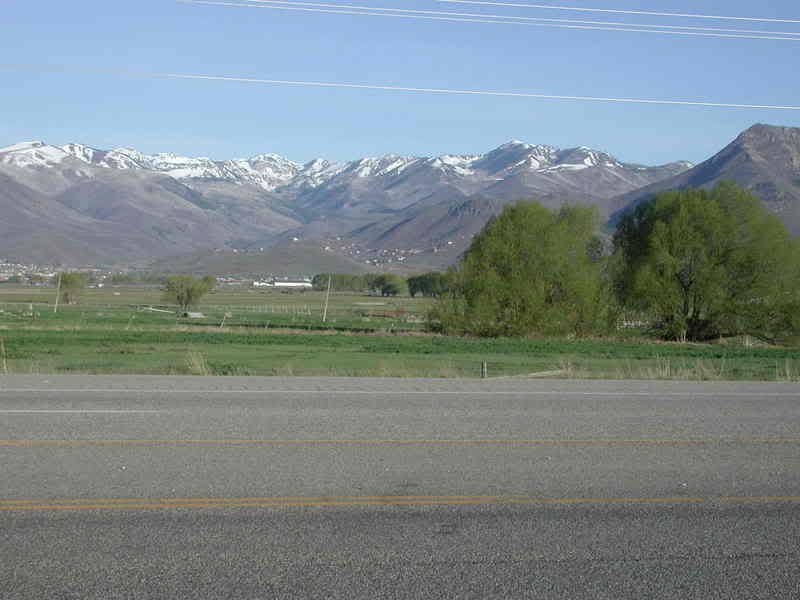
This is a shot of snake creek (Wilson peak can be seen on the far right). This goes over "Pole Line Pass" and drops into American fork canyon. This is a heavy snowmobile winter route ... early morning, you might make it to the tail head of mineral basin right now, it would be serious wheeling over the top. Over the next few weeks, this will just continue to melt and provide different levels of challenge.

Guardsman’s Pass is the canyon just left of Wilson peak there on the far right.
DSCN2586.jpg


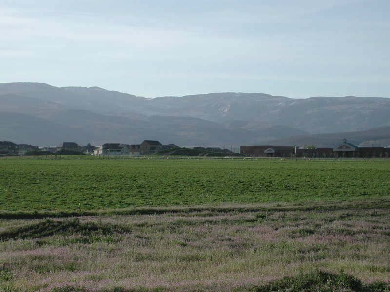
Here are some shots taken on Mill Road (about center of town, but about 10000 west). Shots are looking at the eastern ridgeline:

Looking South East is “Center Creek”. This road accesses Mill D (drops into Strawberry reservoir), West Fork of the Duchesne (drops into Hanna), Soap Stone Basin (drops into Mirror Lake highway), or drops back into Woodland, or drops into Current Creek by Fruitland. There are literally hundreds of miles of tails up here.

DSCN2587.jpg


Looking straight east is “Lake Creek” This road ties into all of the above, “friendlier way” to the top than Center creek.

DSCN2588.jpg


Looking a bit North east is “Pole Canyon”. This accesses Heber Mountain (dropping over into Woodland). It also follows the ridgeline and ties back into the above two.

DSCN2589.jpg


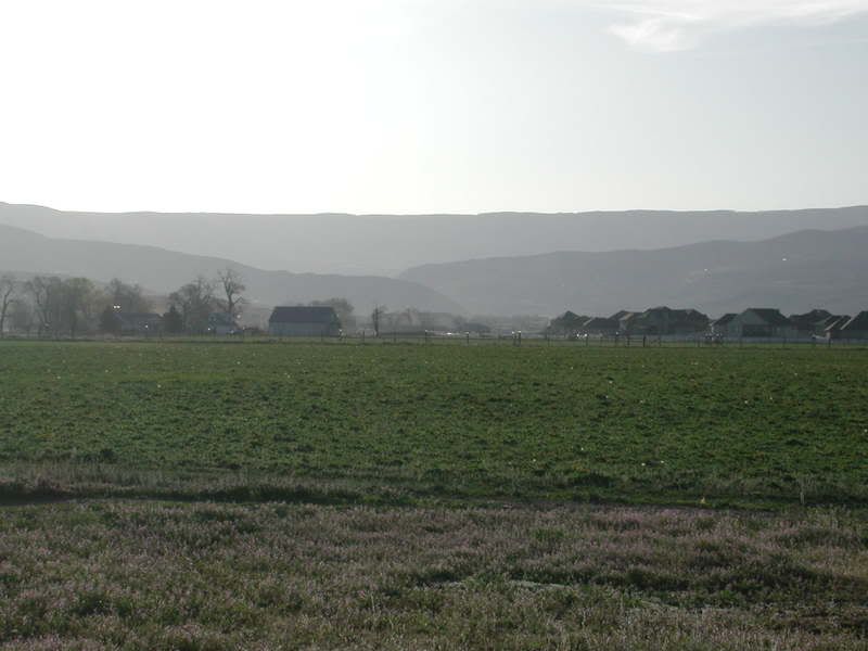
These last 3 pictures are looking at the South Western exposure of “Heber Mountain” area, thus it looks snowless to the top. However, access to all of the above mentioned places will remain in north eastern snow areas (think big drifts in the middle of the road in some places) until mid june. Right now, High challenge. Two weeks medium challenge, Month, light challenge, two months, 2 wheel drive.
 

timpanogos

Push to the Peak
Location
Heber
btw, Heber valley is about 35 minutes drive from mouth of Parleys canyon.

Need at least two and preferably three rigs to get wild and crazy, who wants to play over the next month?
 

timpanogos

Push to the Peak
Location
Heber

Your "Pussy ears" (and thats a movie quote!), are not worthy of the love to be made here!

oh and please make sure to post yet another picture of you making it over the "water fall" mid-trial on rattlesnake! You did make it right?:rofl:
 
Last edited:

cruiseroutfit

Cruizah!
Moderator
Vendor
Location
Sandy, Ut
OK, Bald Mountain makes sense... so which trail were you on... Are any of the mines still open up there? I have never been on the spur between Gauardsman Pass and Heber... What would the trail be like in the summertime? Dirt road? Is it private property? Legal?
 

Attachments

  • Bald_Mountain (Medium).jpg
    Bald_Mountain (Medium).jpg
    99.3 KB · Views: 32
Last edited:

timpanogos

Push to the Peak
Location
Heber
yea, that's the area. The dashed line on the ridge seems about right, however, it only seems right up on the ridge line. It seems the trail switch backs more coming up the west side of the ridge. There is well established dirt road all the way to the southern peak (8932 - Wilson). There is a Radio and TV translation station right on that peak. Is "VABM" a big brass survey marker? The 9363 peak has one on it. There is an old dirt road that drives right over the middle of that peak (not shown on map). There is also a trail to the 8940 peak just north of Wilson (that was serious getting to the top last night).

The trail actually continues from where it is shown ending between the two peaks, and continues to head north, ultimately dropping onto the Guardsmans pass road, on the Park City side road, just about at its summit.

I believe the trail as shown on the map is fine. It was not marked, nor bouldered, nor dug out to prevent access. I believe they keep it open to service the translators. Summer time, 3 like on moab scale.

The trail going up to bald mountain, then continuing north towards park city is likely private and may be frowned upon. There is actually a cool trail that drops down that Pine Canyon. There are mines all over this area.

Several years ago, I had my sons in an old Cherokee and was driving up to the top of the 9363 peak (steep hill). There was a guy on a tractor cutting mountain bike trails down off the top of Deer Valley into the trail that leads back to Guardsman’s pass. I remember the dude standing there yelling with his fist in the air at us. It was ironic, in that I was on a road cut to put in the survey marker in the early 1900’s, he was cutting a new trail in the mountain, and yelling at me for being in the wrong. So, like I say, from the dashed lines on your map north, was old 4x4 roads for years (I did these when in high school), but has been taken over by the politically correct, high money bicycles, which you will likely encounter if you venture that part of the tail. There are lots of mine shafts on that northern leg.


Drop me a map one to the west of that one, so I can see where the trail we took crosses the creek and ties into Guardsmans pass on the State Park side.
 

cruiseroutfit

Cruizah!
Moderator
Vendor
Location
Sandy, Ut
...Is "VABM" a big brass survey marker? The 9363 peak has one on it.

Vertical Angle Bench Mark from a google search... but they are the brass survey markers.


...Drop me a map one to the west of that one, so I can see where the trail we took crosses the creek and ties into Guardsmans pass on the State Park side.

Here you go:
 

Attachments

  • Bald_Mountain (Medium) (2).jpg
    Bald_Mountain (Medium) (2).jpg
    89.9 KB · Views: 12
Top