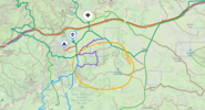
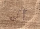
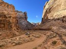
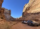
Eagle Canyon in San Rafael Swell and Black Dragon

ozzy702

Well-Known Member
Location
Sandy, UT
Looking at doing Eagle Canyon from East to West, just curious on current conditions. Some of the reports back in ~ 2016 show a tight squeeze on rocky hill climb. I doubt that I could do that right now with open diffs and no rock sliders. Curious if that climb out is still difficult, I saw one report that said work was done to make that part easier. Also curious on the exit since going under I-70 on this video looks VERY tight. I'm guessing that's the western route out instead of heading east onto what looks like an easy ramp onto I-70 at 38.86489, -110.85115

We'll have a lifted Sequoia on 35s with open diffs, a 5th gen 4runner with a 2" lift and 32" tires and open diffs, and a 5th gen 4runner with a 3" lift and 33" tires and rear locker. None of us are running rock sliders, aftermarket skid plates and bumpers yet and we're all on either new Toyo AT3s or Wildpeaks.

We may just hit up Swacey's canyon, all the rock art, and backtrack if the climb out is too nasty.

Also looking to do Black Dragon from West to East. That one from what I can tell doesn't have anything I'm too worried about. There's one difficult section but I believe there's a bypass.

Thanks guys.
 
Last edited:

Hickey

Burn-barrel enthusiast
Supporting Member
Looking at doing Eagle Canyon from East to West, just curious on current conditions. Some of the reports back in ~ 2016 show a tight squeeze on rocky hill climb. I doubt that I could do that right now with open diffs and no rock sliders. Curious if that climb out is still difficult.

We'll have a lifted Sequoia on 35s, a 5th gen 4runner with a 2" lift and 32" tires, and a 5th gen 4runner with a 3" lift and 33" tires. None of us are running rock sliders yet.
We may just hit up Swacey's canyon, all the rock art, and backtrack if the climb out is too nasty.

Also looking to do Black Dragon from West to East. That one from what I can tell doesn't have anything I'm too worried about. There's one difficult section but I believe there's a bypass.

Thanks guys.
You’ll be fine through Black Dragon all the way to Temple Mountain Road. We ran it last year in our stock Gladiator Mojave. It just a bumpy road once you get a couple miles west of the petroglyph panel.
 

Kevin B.

Not often wrong. Never quite right.
Moderator
Location
Vehicular limbo
There's nothing between Swazeys and the underpass in Eagle Canyon that'll make any of those rigs think twice. I haven't been north of the underpass for a long time and I can't say for sure but I wouldn't expect anything on that side to slow you down either.

And Black Dragon isn't rough, typical washbottom route for most of it. A couple spots that might make you pick a line.
 

ozzy702

Well-Known Member
Location
Sandy, UT
You’ll be fine through Black Dragon all the way to Temple Mountain Road. We ran it last year in our stock Gladiator Mojave. It just a bumpy road once you get a couple miles west of the petroglyph panel.

There's nothing between Swazeys and the underpass in Eagle Canyon that'll make any of those rigs think twice. I haven't been north of the underpass for a long time and I can't say for sure but I wouldn't expect anything on that side to slow you down either.

And Black Dragon isn't rough, typical washbottom route for most of it. A couple spots that might make you pick a line.

Thank you both for the responses. I have a fair amount of trail time/experience under my belt, but no seat time in this Sequoia. I'll be leading things and the guys in the 5th gen 4runners have both very little trail time/experience and next to no seat time in their rigs so I'm being more cautious than I normally would be. We do have basic recovery gear, but no winches (waiting on my bumper).
 
Last edited:

ozzy702

Well-Known Member
Location
Sandy, UT
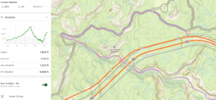
This is the route I'm looking to travel from East to West. Hopefully I haven't missed anything. We were going to pop up and do head of sinbad, then hit the Lone warrior on the way down to Swacey's cabin. I guess that may cut out that middle section through what looks to be a canyon. I've been out to anywhere near this part of the state so trying to do all the beta fact finding and planning possible ahead of time. Eagle Canyon East to West.PNG
 

ozzy702

Well-Known Member
Location
Sandy, UT
There is snow at the top right now. Not a lot, but enough to make it slick

Is this the "top" you're talking about or the highest point of the trail at Swacey's cabin? The exit out at the end looks steep on the topo.
Slick as in not advisable for the rigs we'll have? I really appreciate your input. Is this exit the recommended route or should I go left and try to get out via the very tight tunnel to the west over by Justinsen flats?
Eagle Canyon 2.PNG
 
Last edited:

anderson750

I'm working on it Rose
Location
Price, Utah
Is this the "top" you're talking about or the highest point of the trail at Swacey's cabin? The exit out at the end looks steep on the topo.
Slick as in not advisable for the rigs we'll have? I really appreciate your input. Is this exit the recommended route or should I go left and try to get out via the very tight tunnel to the west over by Justinsen flats?
View attachment 167213
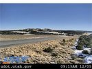
I wouldn't say its not advisable in those rigs. I think you would be fine from a vehicle standpoint for the most part other than having open diffs and it possibly being icy on the climb out. The cameras do not show a lot of snow is still there, but down in the canyon where you climb out will still have ice possibly.

10740--1.jpg
 

moab_cj5

Well-Known Member
Supporting Member
I have run those trails many times over the past few years for Cruise Moab. Unless there is a big flood to change things, you wont have too many issues with Eagle Canyon or Black Dragon.

For Eagle Canyon running East to West, you are going down from Swasey's cabin, and other than a tight spot (circled in Red) you won't have any issues decending into the canyon.

Once in the canyon there shouldn't be any real obstacles. You wind in and out of the wash and its nothing terribly technical until you go to climb out (unless there has been a HUGE water event to change things).

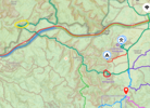
On the West end, on the climb out (circled in yellow) it could be a bit challenging with steep, loose ledges, but you shouldn't have any real trouble. It is a narrowish shelf road, but nothing too out of the ordinary.
1701793866692.png

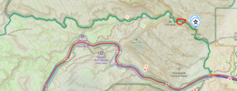
For Black Dragon going East to West, you shouldn't have too much trouble. There are a few spots to pay close attention to as they can be tight, but only one is a ledge that might give you issues (circled in red below). It has an easier bypass to the north around a boulder that requires a tight turn, but should be easy in the vehicles you are taking.

1701794239644.png

Once you start to climb out of the canyon, it is just a bumpy road the rest of the way to Buckhorn Wash RD.

I havent driven your exact route through the middle, but some of the roads in the center of the area can be TIGHT with overgrowth, and slow going (circled in orange). The main roads though are wide and fairly well maintained.

1701794596882.png

Have fun! 2 really great and scenic trails!
 
Last edited:

ozzy702

Well-Known Member
Location
Sandy, UT
I wouldn't say its not advisable in those rigs. I think you would be fine from a vehicle standpoint for the most part other than having open diffs and it possibly being icy on the climb out. The cameras do not show a lot of snow is still there, but down in the canyon where you climb out will still have ice possibly.

View attachment 167220

Thank you very much! Good to know there's a UTOD camera there.

I have run those trails many times over the past few years for Cruise Moab. Unless there is a big flood to change things, you wont have too many issues with Eagle Canyon or Black Dragon.

For Eagle Canyon running East to West, you are going down from Swasey's cabin, and other than a tight spot (circled in Red) you won't have any issues decending into the canyon.

Once in the canyon there shouldn't be any real obstacles. You wind in and out of the wash and its noting terribly technical until you go to climb out (unless there has been a HUGE water event to change things).

On the West end, on the climb out (circled in yellow) it could be a bit challenging with steep, loose ledges, but you shouldn't have any real trouble. It is a narrowish shelf road, but nothing too out of the ordinary.
View attachment 167221

For Black Dragon going East to West, you shouldn't have too much trouble. There are a few spots to pay close attention to as they can be tight, but only one is a ledge that might give you issues (circled in red below). It has an easier bypass to the north around a boulder that requires a tight turn, but should be easy in the vehicles you are taking.

View attachment 167222

Once you start to climb out of the canyon, it is just a bumpy road the rest of the way to Buckhorn Wash RD.

I havent driven your exact route through the middle, but some of the roads in the center of the area can be TIGHT with overgrowth, and slow going (circled in orange). The main roads though are wide and fairly well maintained.

View attachment 167223

Have fun! 2 really great and scenic trails!

Fantastic info. I really appreciate it. You guys are making me feel a lot better about things.
 

ozzy702

Well-Known Member
Location
Sandy, UT
Unless the rock has shifted, that tight spot is just about three blonde ones wider than an Excursion.
Hmmm.... my 2nd Gen Sequoia is a fat pig but it's got a lot shorter wheelbase than an Excursion and should be a hair narrower. Less ground clearance too though.
 

moab_cj5

Well-Known Member
Supporting Member
Unless the rock has shifted, that tight spot is just about three blonde ones wider than an Excursion.
I've always been in a really capable vehicle and have never gone that route, I've always gone up the ledge. Although, I did take a terrible line once and required a winch to get up as I was hung up pretty bad on the rear axle.

With enough rock stacking and a good eye for a line, a fair number of trucks could get up it without going around the boulder.
 

ozzy702

Well-Known Member
Location
Sandy, UT
We did Black Dragon, no problem although it was a snowy, then slushy, then muddy mess getting there from the West. If I had to do it over gain I'd avoid that long drive in and just go in from the East, up to the end of the canyon and turn around and come back out.

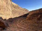
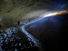
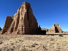
Didn't do Eagle Canyon. Too much snow for me to want to risk it so we ended up doing Cathedral Valley via Goblin Valley and it was amazing.

I'll save Eagle Canyon for when it's snow free. Again, I appreciate all your input!
 
Top