Trip Report: Hole in the Rock March 22-25 2012

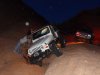
if i looked at your pic right it's downhill, south of the chute. not a very far walk either. Just gotta go up and around a few of the pools.

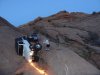
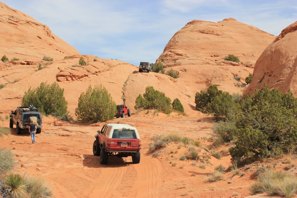
we parked here, right at the bottom of the shoot just above the "frog pools" as i call them.
100_3809.jpg

this is it.
100_3817.jpg


100_3818.jpg

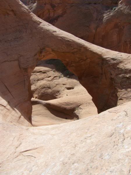
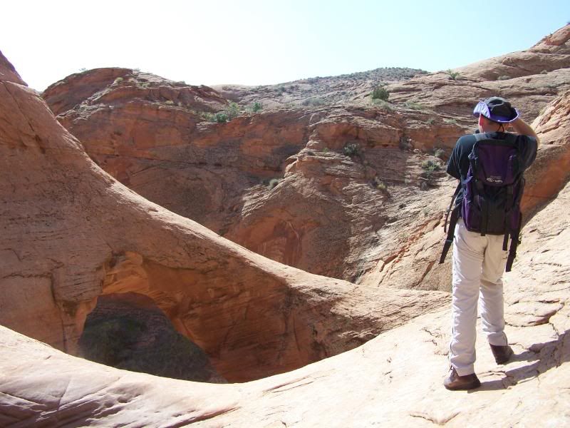
only pics i could find at the moment

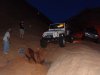
one of these days i'm gonna go in there while a massive rain storm is going on to see the water fall that goes through it.
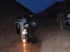
 

4biker

Active Member
TRD270;830266 Great report Steve said:
https://picasaweb.google.com/111271150371423817183/HITR2012?authuser=0&authkey=Gv1sRgCNWDqIyY897tCg&feat=directlink[/URL]


On a side note, a good amount of my pictures came from hanging my camera out the window and snapping a pic, so don't judge the crookedness :greg:

Great pics Josh! I think you took the best pictures of my 4Runner. It's always tough to show the magnitude of what we're driving, but you got some great shots! I hope it's okay I downloaded a bunch of them.

also, Steve, day 2 looks good so far!
 

TRD270

Emptying Pockets Again
Supporting Member
Location
SaSaSandy
Great pics Josh! I think you took the best pictures of my 4Runner. It's always tough to show the magnitude of what we're driving, but you got some great shots! I hope it's okay I downloaded a bunch of them.

also, Steve, day 2 looks good so far!

Download all you want, thats why I shared them, it would be nice if I could make a living as a photographer, but i'm not so go nuts.
 

frieed

Jeepless in Draper
Supporting Member
Location
Draper, UT
Steve,

Methinks you have outdone yourself so far. This may be the standard by which future trip reports are measured!

That said, what would be really cool (and helpful to future trail runners) is the GPS coords for the vicinity of the pictures since the pictures tend to clump at hikes, obstacles, or camps. Or better yet, a Google Earth path with markers for the above.

Also, please, please, tell me somebody got a pic of that seemingly near vertical fin we traversed to and from the end of the trail ..
 

kuefzj

Member
Location
Sandy, Ut
Here are the pics of Don's Jeep.
 

Attachments

  • DSC00566.JPG
    DSC00566.JPG
    20.7 KB · Views: 62
  • DSC00569.JPG
    DSC00569.JPG
    31.4 KB · Views: 63
  • DSC00573.JPG
    DSC00573.JPG
    21.2 KB · Views: 56
  • DSC00575.JPG
    DSC00575.JPG
    26.2 KB · Views: 61
  • DSC00576.JPG
    DSC00576.JPG
    21.7 KB · Views: 60

TJDukit

I.Y.A.A.Y.A.S.
Location
Clearfield
Don and Duane...I'm really sorry I failed you guys out there. I was the last one up the hill before this happened, I really do feel responsible for leaving you guys behind. I somehow thought I was the last one.
 

kuefzj

Member
Location
Sandy, Ut
I didn't get a lot of pics with everyone, my rig was slowing us down. I need new shocks!!! Top of the list!!
Before we left we went to halls crossing and we also stopped at the Hite overlook. You can see the boat
ramp completely out of the water.
 

kuefzj

Member
Location
Sandy, Ut
Don't worry about it, every trip is a learning experience. Everything worked out ok.
Don and Duane...I'm really sorry I failed you guys out there. I was the last one up the hill before this happened, I really do feel responsible for leaving you guys behind. I somehow thought I was the last one.
 

4biker

Active Member
Steve,

Methinks you have outdone yourself so far. This may be the standard by which future trip reports are measured!

That said, what would be really cool (and helpful to future trail runners) is the GPS coords for the vicinity of the pictures since the pictures tend to clump at hikes, obstacles, or camps. Or better yet, a Google Earth path with markers for the above.

Also, please, please, tell me somebody got a pic of that seemingly near vertical fin we traversed to and from the end of the trail ..

Here is a not very great pic of that fin
IMG_2329-1.jpg
 

Max Power

Bryce
Location
Sandy
I'm glad that you guys were able to get it upright. I am also glad that nobody got hurt. I hope the flop doesn't keep you from going on future trips.
 

sixstringsteve

Well-Known Member
Location
UT
At last the trip report is complete. I'll get around to editing the video one of these days, and I need to add some GPS coordinates into the last post, but the report is there. Thanks for following along.
 

TJDukit

I.Y.A.A.Y.A.S.
Location
Clearfield
Fantastic report Steve. I wanted to wait until you were done to tell you what an amazing job you did...much better than I would have been able to accomplish. I would wheel with anyone of these men and women again. Jessica did an awesome job driving the white JK when Eric let her, a lot of the time she was driving I was right behind and would not have chosen a different line.

It's great to explore new places and meet new friends. I only hope the next time I can take my wife and daughter along.

Can't wait to see some of you in Moab for the RME BBQ.
 

4biker

Active Member
Eric, those are some spectacular shots of the amazing sunrise that morning. It was tough keeping up with you and Frieedling driving out on Sunday morning. I chuckled when you blazed up that first big off-camber obstacle like it was nothing and then asked "is that the one you had to spot me on?"

Great trip report, Steve! Thanks for summing up a great trip, and I agree with your summary. Also, thanks for putting the trip together, and intrepidly leading (with Scott) through the whole thing without many hiccups. I always felt confident and safe following the vehicles ahead of me, and with all of the great spotting when I was sketched out. Honestly, I'm just glad I didn't slow us all down. I'd do it all again with the same group in a minute.
 

DAA

Well-Known Member
Great Trip Report! Lots of good pictures.

I was kind of like deja-vu all over again when I saw this picture.

IMG_3143.jpg


I ended up with a very similar repair on HITR.

IMG_3188.jpg


- DAA
 
Top